MT. BEACON INCLINE
- Program
- Subject
- Location
- Lat/Long
- Grant Recipient
-
NYS Historic
-
Site, Transportation
- 783 Wolcott Ave, Beacon, NY 12508, USA
- 41.493844024488, -73.96016013618
-
Beacon Historical Society
MT. BEACON INCLINE
Inscription
MT. BEACON INCLINE2,364 FT. CABLE RAILWAY
OPENED 1902 WITH 64% GRADE.
CARRIED MILLIONS OF PASSENGERS
BEFORE CLOSING BY 1978.
DESTROYED BY FIRE 1983.
WILLIAM G. POMEROY FOUNDATION 2025
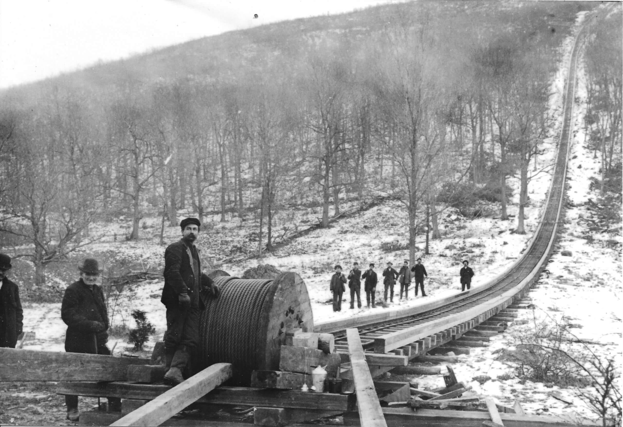
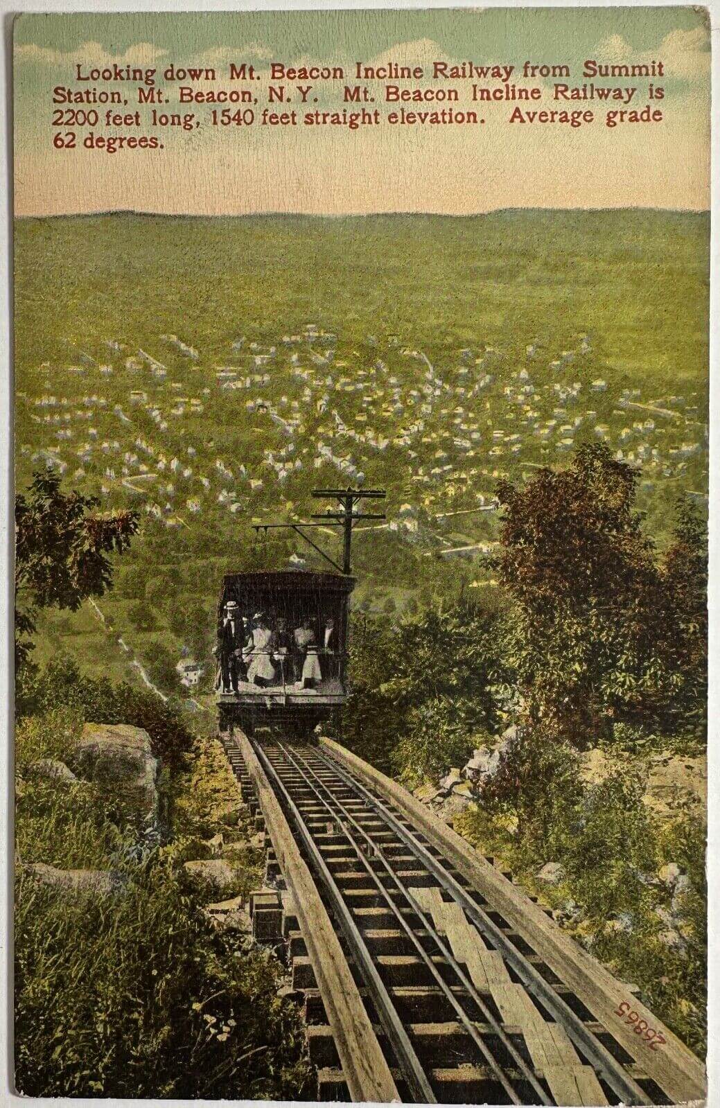
The Mount Beacon Incline Railway, in Fishkill, New York, opened to the public on Memorial Day, 1902. After carrying a total of 1,400 passengers on its first day, the electric railroad became a tremendous success. The cable railway had been built to take advantage of the gorgeous mountaintop view that was only accessible by traveling for several hours on foot or by wagon. The 2,364-feet engineering marvel was built by the Otis Elevator Company of Yonkers and originally owned and operated by the Mount Beacon-on-the-Hudson Association. With a staggering 64% incline, the Mount Beacon Incline Railway was one of the steepest funiculars in the world. The railway became a popular tourist destination when a hotel, casino, and bungalows were built on the top of Mount Beacon. After 50 years in service, Mount Beacon Incline Railway had carried a total of 2.5 million passengers.
As revenue declined, and the tracks fell into disrepair in the early 1970s, Mount Beacon Incline Railway paused its operations. It reopened in 1975 after major reconstruction. On Memorial Day 1977, the incline railway was put in operation to celebrate the 75th anniversary of its first ascent. In 1978, the county was forced to seize the railway after the former owner failed to pay taxes on the property for three years. The abandoned structure became victim to vandalism and arson. The casino burned to the ground in 1981, and the railway was destroyed by flames two years later. The Mount Beacon Incline Railway was eventually dismantled, and the only remnant of the structure is its former pathway, which was converted into a hiking trail.