ERIE CANAL
- Program
- Subject
- Location
- Lat/Long
- Grant Recipient
-
Historic Transportation Canals
-
Transportation
- Kennelley Park Gazebo, 2 West Ave, Fairport, NY 14450, USA
- 43.101642, -77.442486
-
Fairport Local Development Corporation
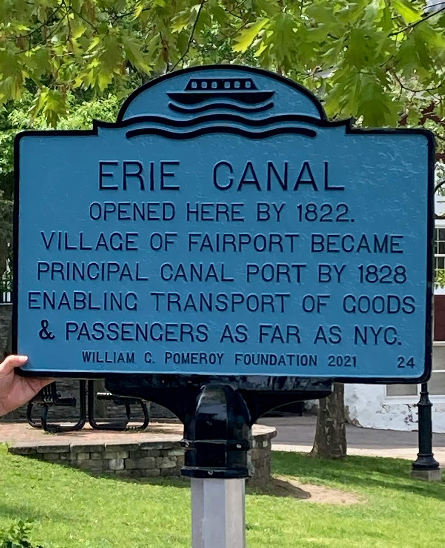
ERIE CANAL
Inscription
ERIE CANALOPENED HERE BY 1822.
VILLAGE OF FAIRPORT BECAME
PRINCIPAL CANAL PORT BY 1828
ENABLING TRANSPORT OF GOODS
& PASSENGERS AS FAR AS NYC.
WILLIAM G. POMEROY FOUNDATION 2021
Requiring nearly a decade to complete, the Erie Canal remains an impressive feat of engineering. Spanning 363 miles, this artificial waterway featured locks, bridges, and aqueducts along its path through the diverse geography of New York State. It connected the Great Lakes region to the commercial hub of New York City; in many instances, the canal utilized natural waterways and lakes as a means of reaching interior communities. Several branch canals were constructed in subsequent decades until railroads superseded the canal system.
The Erie Canal opened through most of Monroe County in 1822, including what is now the Village of Fairport. An early canal passenger described his travels in this area in the July 16, 1822 issue of the Connecticut Courant:
We lodged that night at Palmyra, and the next morning we arrived at Heartwell’s Basin in Pittsforfd, (8 miles from Rochester,) where the present navigation of the canal terminates. I have thus travelled 174 miles by boat – 159 on the canal, 15 on the river Clyde.
By 1828, Fairport was recognized as a principal canal port in the Erie & Junction Canal Directory. The transport of freight and passengers bolstered economic development and opened Fairport to larger markets.
As of 2021, the marker stood in the Village of Fairport’s Kennelley Park, where the Erie Canal is now a recreational resource.