FREEPORT RIVER
- Program
- Subject
- Location
- Lat/Long
- Grant Recipient
-
NYS Historic
-
Industry & Commerce, Site, Transportation
- 241 S Main St, Freeport, NY 11520, USA
- 40.651723, -73.575649
-
Freeport Landmarks Preservation Commission
FREEPORT RIVER
Inscription
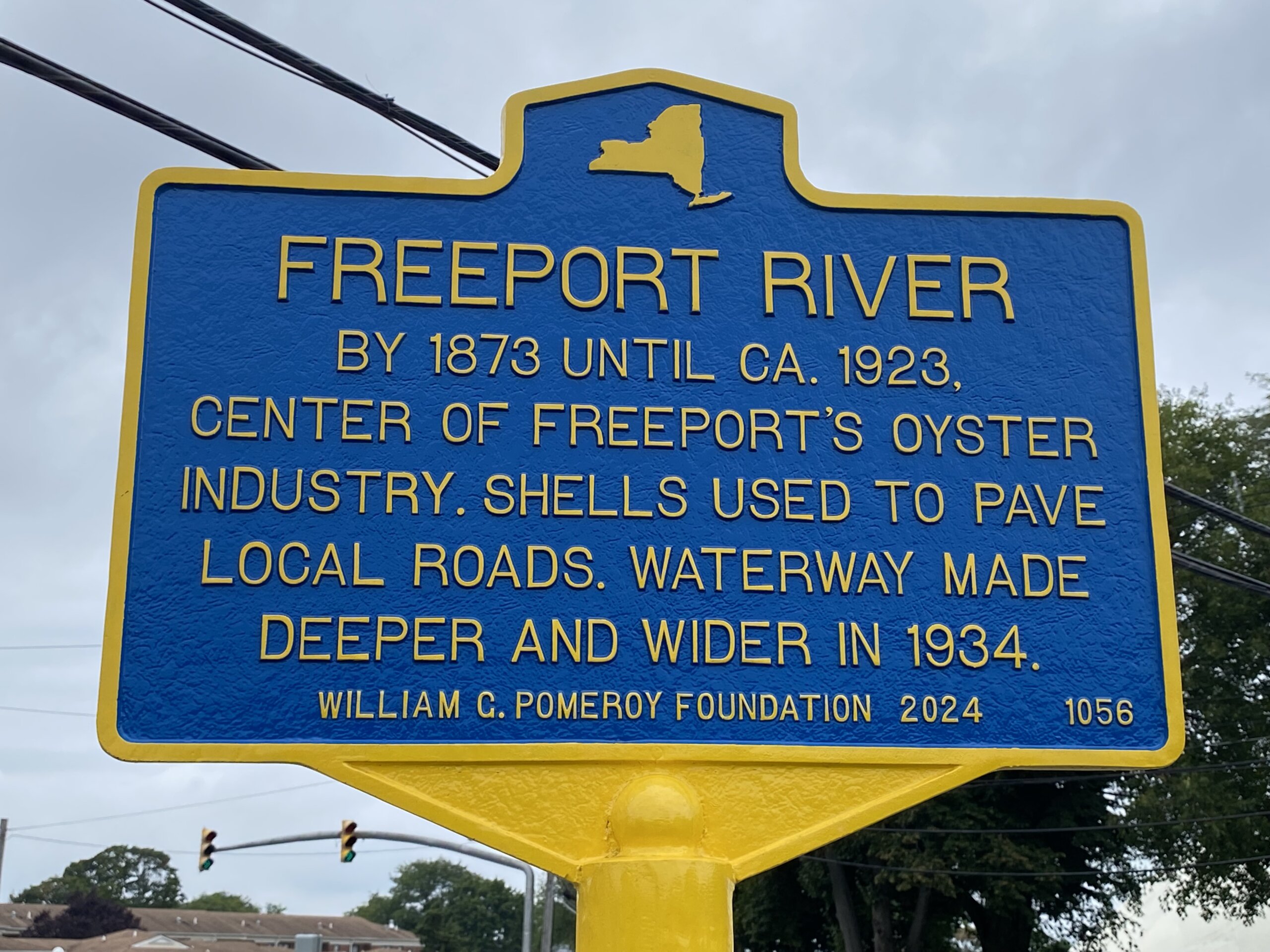
FREEPORT RIVERBY 1873 UNTIL CA. 1923,
CENTER OF FREEPORT'S OYSTER
INDUSTRY. SHELLS USED TO PAVE
LOCAL ROADS. WATERWAY MADE
DEEPER AND WIDER IN 1934.
WILLIAM G. POMEROY FOUNDATION 2024
By 1873, Freeport River was the center of the village of Freeport’s oyster industry. The oyster industry grew to employ many people in the area, with the river lined with oyster houses. In 1892, Captain Thomas L. Casey of the Corps of Engineers in the U.S. Engineer Office reported that the Freeport oyster industry employed around 100 men at that point and produced around 40,000 bushels of oysters a year. The oyster industry loomed so large in Freeport, that the village even used discarded shells to pave local roads, including Main Street in 1904.
By the 1920s, Freeport’s oyster industry began to dwindle, with some of the last oyster houses on the river closing around 1923. In 1934, the waterway was made deeper and wider, to a depth of about three feet at low tide. According to the January 17, 1934 Brooklyn Times Union, the project was advocated for by locals, “when it was discovered that, due to the construction of the new State Meadowbrook Causeway, Freeport River had filled with silt.”
As of 2023, Freeport River continues to be enjoyed by locals and visitors to the village, and serves as a lasting vestige of the important, though short-lived, maritime industry in the village of Freeport.